Super Cyclone to Impact Bihar: Cyclone Amphan latest updates
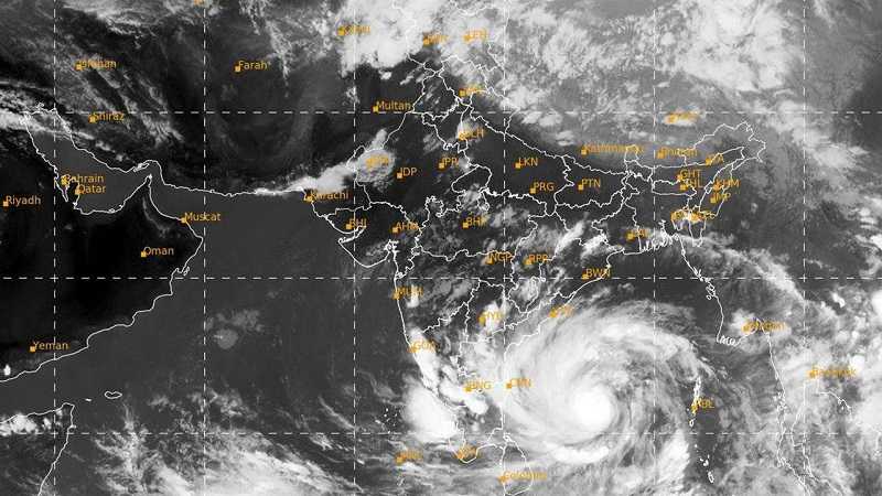
Super Cyclone to Impact Bihar, Cyclone Amphan has intensified into a super cyclone cyclonic form an extremely severe cyclonic storm on late Monday afternoon. The cyclone is rapidly moving towards the coasts of west Bengal and Bangladesh, where it is expected to make the landfall on May 20th. The states of West Bengal and Odisha are on high alert. Bihar also likely to have an impact.
The India Meteorological department said that Amphan is likely to cross West Bengal and Bangladesh on Wednesday as a cyclonic storm. Cyclone Amphan is expected to carry out wind speed of 155 -165 kmph, gusting to 185 kmph.
It is likely to trigger moderate to heavy rain across the Bihar state from next four to five days. It is likely to develop into an extremely severe one on Tuesday generating high wind speed.
According to the daily weather newspaper news it has been said by the Indian Meteorological Department (IMD) on Monday evening the state will witness thunderstorm accompanied by lightening and gusty winds at an isolated places from Tuesday till Friday. The intensity of thunderstorm is likely to increase on Wednesday.
Patna meteorological centre issued another bulletin that on Monday rainfall is accompanied likely to many parts of the state, north eastern and south eastern districts on May 20th & May 21st. Centre parts of Bihar which includes Patna are also likely to get thunderstorm and thunderstorm on Wednesday and Thursday.
ALSO READ: Job Generation: Bihar Industry Department Profiles 77k Migrant Workers
On the expected conditions in Bihar, the north-eastern districts, particularly Araria, kishanganj, katihar and purnia are likely to witness thunderstorm. Activities along with gusty winds on May 20th and May 21st. Super Cyclone to Impact Bihar are likely to witness heavy rainfall, while southern parts, of the state in likely to witness cloudy weather and light shower at isolated Place.